Machinery Focus: CultiWise saves costs with satellites and drones


Digital technology can bring huge benefits to farming and farm management, that is beyond question; what is not quite so simple is how best to introduce and integrate it into a farm operation.
In many cases this has already happened to some extent with satellite navigation on the tractor and various programmes in the farm office for herd or fleet management.
Yet, there is one application that is often talked about but has yet to make any great headway in Ireland and that is prescription maps for variable rate application and, more lately, spot spraying.
The idea behind both is simple enough; not all land will respond equally to a blanket application of inputs, nor are weed infestations consistent across fields.
Therefore, there is huge potential for cost savings if the amount of fertiliser or herbicide could be adjusted to suit either the soil's potential or the degree of weed cover.
Yet, although the idea is straightforward, putting it into practice uncovers a whole new universe of variables which need to be contained and disciplined into a form that can be understood and acted upon by farmers and their advisors.
One company that has been tackling this head on since 2016 is CultiWise from Brno in the Czech Republic, which started up when three university students got together to bring a passion for digital technology to agriculture.
Today, the system it has developed is now being used by 550 growers throughout Europe with Denmark leading the way in adopting the product.
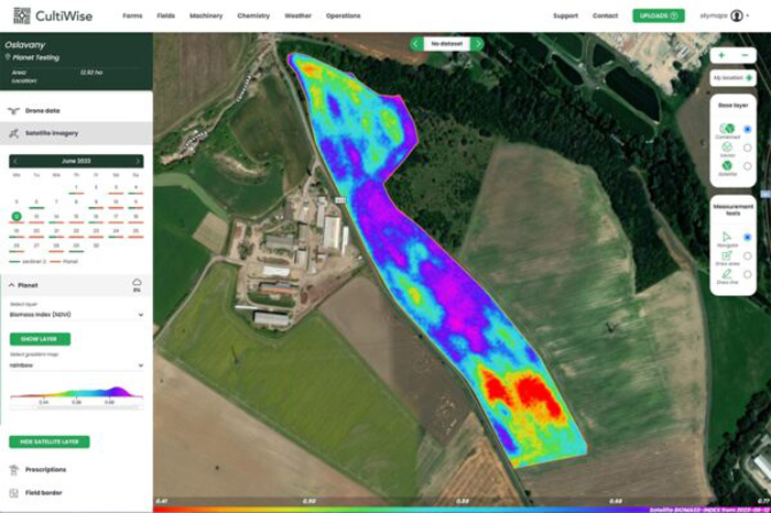
CultiWise is described as all-in-one farm management software that creates prescription maps for spot spraying and variable rate application based on data gathered by drones, satellites, soil samples and historical records.
It is bringing together this mix of data sources that is the key to the software.
Often they are considered on a separate basis and in a static format, whereas Cultiwise can monitor the growth of crops and disease or weed pressure as they evolve during the season.
CultiWise uses satellite imagery as the fundamental source of data for building up its maps but there are problems with relying on this alone as cloud cover can reduce the frequency of updates and resolution is limited.
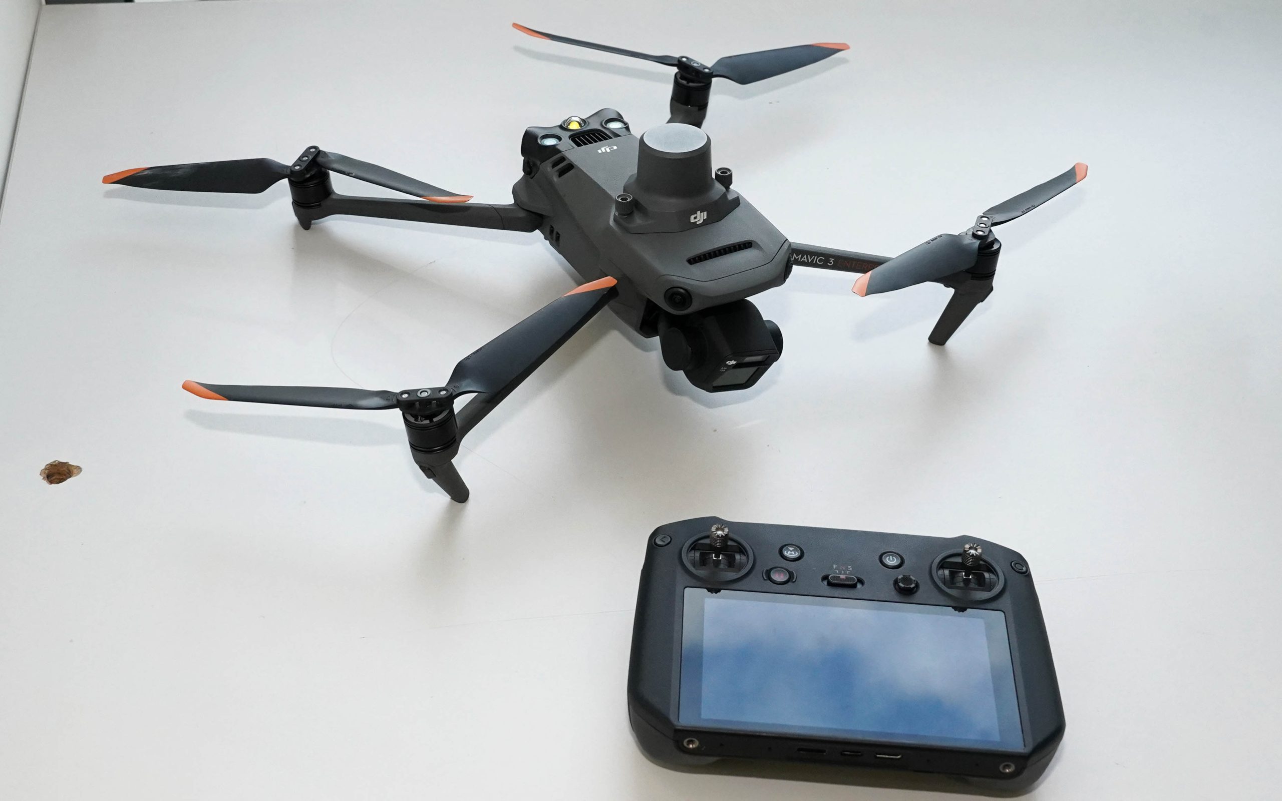
To complement the satellite imagery, drones are called upon to give a clear picture of what is happening to the crop and improve resolution to the point that plant populations can be measured.
The identification of individual plants by drone allows an analysis of germination rates and crop vigour along with the differentiation of weeds from crop plants post emergence.
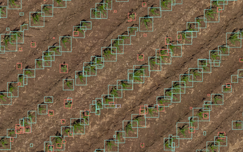
By doing so, a programme of spot spraying can be implemented with the potential for significant savings in chemical costs, alongside the ability to use chemicals at full rate on the selected areas should their use be limited by legislation to lower rates per hectare.
Naturally the biggest savings are to be had with individually activated nozzles, but even with 1m section control, the savings are significant according to the company.
Treatment with plant growth regulators and fungicides can also be managed with the software which will highlight the areas of high crop density, which may be more at risk from fungal disease.
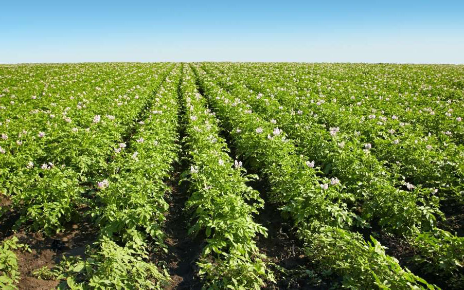
Variable rate application of inputs such as seed and fertiliser is often based on historical yield records but there are problems with doing so, not least of which is that a combine with a 30ft header is a very blunt instrument for measuring yield over an area which is otherwise being analysed on a per plant basis.
CultiWise takes a different approach in that it produces yield potential maps based on current and historical biomass analysis along with soil sampling.
This can present a much more detailed prescription map than recording past yields alone and so increases the efficiency of fertiliser and seed use.
Having generated a map of potential yield at a certain level of inputs, it can be adjusted to forecast the effect of different application rates, so helping to optimise the management of the farm and forecast the value of the crop against the cost of growing it.
In addition to the reliance upon images taken with a standard digital camera sensor, referred to as RGB (Red Green Blue), CultiWise can also use spectral analysis to derive Normalized Difference Vegetation Index (NDVI) maps that can indicate ground cover and plant health.
Although CultiWise is primarily a software product, the company does also sell the drones by which the data can be gathered, however, the system is by no means tied to any particular make or model.
The cost of the software is based on area covered and services purchased; it is available on a pay-as-you-go basis or as a package deal.
A drone with standard RGB camera and appropriate software is around €4,000 while one equipped with a spectral sensor in addition to the RGB camera will be around €40,000.
This does appear to be an expensive way forward but the savings can easily cover the costs.
CultiWise is claiming that a 90% reduction in pesticide use is possible in specific conditions while it also noted that a sprayer can cover a far larger area between fills, saving time and running costs.
In Ireland, CultiWise is being sold and distributed by Farmhand of Dublin which has been following the company's progress over the past year or so.
While there are many products available for producing variable rate application maps, CultiWise appears to have taken the game further by incorporating various sources of data and ignored the yield mapping cul-de-sac of other offerings.
Critics of sophisticated software such as this will point to the old adage that the best fertiliser for the land is the farmer's boot, yet large acreages and the capabilities of modern machinery has required this maxim to be modified.
Observing the land and what is happening upon it as the seasons progress can now be done far more effectively by digital technology, but adapting to a reliance on remote sensors rather the human eye is not a switch that everyone can happily make.